Drone, the popular name for Unmanned Aerial Vehicle (UAV), is beginning to proliferate the Indian market with its varied range of applications. From its early beginning in military uses, the gamut of its application has spread widely to encompass civil and commercial activities. In a not so distant future, drones are expected to replace the courier and food delivery personnel and the technology is already being tested by companies such as Amazon and Zomato!
Not surprisingly, India is touted to be one of the fastest growing markets for drones, with an expected market value of $900 million by 2021.
While the scope of its application is spread across the areas of disaster relief, law enforcement, forest conservation and agriculture among many others, its utility in general surveying and mapping is proving to be a tremendous advantage. This is corroborated with the fact that the usage of drones in Indian construction industry is almost growing at a whopping 250% year-over-year!
Surveying and Mapping – Technology providing the edge
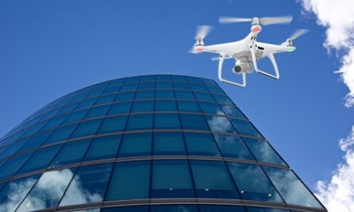
The survey and mapping activities have often required substantial scale of manual efforts. For instance, a close inspection of Dams & building façade can prove challenging – one has to manage to capture high quality photos from the ground, or find suitable vantage points for a good view. Often, the inspection personnel have to climb an exterior wall or drop down a scaffold from the roof. These challenges get manifold when the consideration such as Chimneys or high-storied structures.
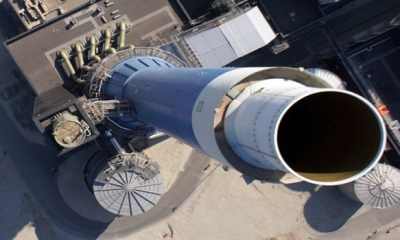
Visual Inspections of Dams, chimneys and Building facades or difficult-to-access rooftops and outer surfaces, they have multiple challenges of not just accessibility and human safety, but also lead to a manifold increase in costs, efforts and time required.
Come drones, the game changer in this industry that provides an effective solution to the many challenges encountered. The survey and mapping and Inspections efforts can now be carried out at a fraction of cost, requiring minimal manual efforts and manpower on the field. The earlier time requirement of many hours or days can be reduced by as much as 90%. Inaccessible areas such as Dams, chimneys and rooftops can be duly captured with this technology. High resolution 4K cameras on the drones capture the footage while beaming it live to the UAV operator on the ground. These miniature sized-devices have the ability to fly hundreds of feet high in air and cover up to a distance of 2kms in one go. These can be maneuvered in air easily by a skilled operator, providing a 360 degree view of the subject, while also remaining stationary mid-air for effective photo and footage capture. The information captured enables detailed analysis and tracking, aided by software solutions for a comprehensive 3D mapping. Thematic mapping to identify presence of moisture or water infiltration for instance can be done using thermal imaging and other cameras. The GPS logs provide coordinates and lay the path traversed during the drone operation for a comprehensive solution.
Service providers in the survey and mapping industry are ushering in this technology in other areas apart from the construction industry. In the infrastructure industry, survey and mapping are being done for projects related to roads, railways, as well as for development of cities and villages. Utility services using this technology are in the areas of powerlines, telecommunication, pipelines and solar energy, while the other major areas of use include agriculture and mining.
Service Offerings to the Industry
With the plethora of advantages offered and wide applications, the UAV industry in India is set on a high-growth trajectory. Companies are increasing availing the services of survey and mapping companies having skilled drone-operators and necessary expertise. Recent government regulations, on recommendations from latest drone policy, on requirement of UAV Operator permits and allowance to fly in specific ear-marked zones necessitate the clients to ensure the service offering firms meet the requirements and have established credentials in the industry including client testimonials and previous operation expertise. The high value offered is an obvious win-win for both the clients and the service companies with superior work carried out at optimum time, cost, effort and minimal risk.
Drone performing building facade inspection

Drone capture during chimney inspection
